Reference Books Used
“Story of Gen. George Rogers Clark” by Orton Rust, Springfield, Ohio; “Reference to Clark’s Campaign” by Ross F. Lockridge, Bloomington, Ind.; “Ohio Education Bulletin article on Revolutionary War Campaigns” by J. L. Clifton, 1930 director of education for State of Ohio; “History of Archdiocese of Cincinnati from 1821 to 1921” by the Rev. John H. Lamott, S.T.D.
Series of articles in Sidney Daily News by Paul Sherman; History of Ohio by E. O. Randall and Daniel J. Ryan; papers and documents belonging to Miss Marie Quinlan.
Index
- Thruways of the Prehistoric Past
- An American Pioneer
- The Wilderness Trail
- The Portage
- Ohio As French Territory
- Peter Loramie’s Trading Post
- Fort Loramie Is Built
- The Community Is Settled
- Trails, Highways and Canals
- Fort Loramie and the Revolution
- Father Louis Navarron
- St. Michael’s Roman Catholic Church
- Later Community History
Thruways of the Prehistoric Past
At the dawn of American history when the red man held sway over the vast forested continent the network of rivers and streams were the life blood of the nomadic tribes. They afforded the waters necessary for their existence. More important, they afforded the means of transportation for those moving from one hunting ground to another.
The trails, beaten down by the buffalo and later by the Indians themselves, may have been faster to travel, but they did not permit the movement of goods or equipment heavier than a man or beast of burden could carry on his back.
The Indians, thus, chose as their place of living an area that was laced with streams for their movement from one area to another.
The thruways of that day were the broad rivers such as the Ohio and the Mississippi. But other thruways were the streams that connected with portages which ran from one watershed to another. This made the Ohio hunting grounds of such importance. The portages afforded practically uninterrupted water transportation from the Great Lakes to the Ohio River. Such areas of two-way water transportation were indeed the thruways of those early ages. While we of today date our historic past from things and actions connected with the pioneers, these two-way streams may have been the thoroughfares of the prehistoric man along which civilization, even of those remote times, moved slowly toward what we know and have today.
An American Pioneer
J. C. Beltrami, an Italian credited with early information on American rivers and the people in midwest America of the early 18th Century, gave in his book, Pilgrimage in America, published in 1823 his description of a Yankee pioneer:
One group of immigrants who contribute in so extraordinary a manner to the prosperity of this New World is the Yankee. A few words will make you acquainted with their origin and character.
The northeastern states, New York, Connecticut, Rhode Island, Massachusetts, Vermont etc. are very populous and consist entirely of free people. Their inhabitants already think they have not room enough though in Europe each state would form a kingdom; or they perhaps think it is not sufficiently fertile so that when a young man arrives at a certain age and is able by his own strength and intelligence, which are early matured, to provide for himself, his father says to him, “Go, my son, and make money.” If the son asks “How?” he only repeats, “Go and make money.”
The only patrimony he gives him is an axe, a pick, a cord and a bridle. You will understand by these symbolic implements that he must fell forests with his axe, open the ground with his pickaxe for his necessary subsistence; that the cord and bridle signify that he must provide himself with a cow and a horse; and that he must seek all these requisites wherever fortune may direct his steps.
Every year, accordingly, multitudes of Yankees survey from the top of the Alleghanies, these immense regions of the west which they consider as a common patrimony: and each descends into the plain to provide himself with necessaries suggested by his father’s advice and gifts.
The first thing he does after building a house of trunks of trees is to marry; for a wife is not less indispensable to him than the cow and horse. The human animal, unfettered by the fear of wanting bread, is as prolific as the soil. In a few years the spot which only swarmed with insects, swarms with children; the log house becomes a hamlet, a village, a town, the capital of a province; the states are formed as by enchantment from an axe, a pickaxe, a cord, a bridle, a man and a woman—
—But it appears that man can never escape the scourges which afflict humanity. Herds of doctors, and lawyers follow these industrious people and chicanery and death have already established their empire there. Unfortunately there is no Chinese Wall to prevent the incursion of these terrible Tartars.
The Yankees—are a people as laborious as the Swiss, as frugal and economical as the Tyrolese, as cunning and industrious as the Genoese, as droll as the Gascons, as cold and proud as the English and as selfish and avaricious as those men of all nations who banish themselves from their country to make money.
The Wilderness Trail
As one drives over Ohio’s fine highways, going at times from one end of the state to the other in a matter of hours, he may not realize that weeks and probably months were required to traverse the same distance when the first white man saw this happy hunting ground of the Indians.
In some instances, that is before the building of the thruways, the highways followed the trails of the Indians and the early pioneers. And the Indians, in many cases, were following the beaten paths of the buffalo which caused these trails to be there in the first place as a means of going from one feeding ground to another.
As the state developed from the home of the Indian to that of the pioneer and then to a great farm state, but ultimately into one of America’s great industrial complexes, most of this early history is lost to the generations which followed. Expansion of towns and cities and other improvements necessary to meet the needs of the growing communities have wiped out many of the marks of the earlier days.
Some of the more historic areas are trying to protect these marks of the past and thus keep a visual record of the era of the American pioneer. It is feared that in future years there will be little left to pinpoint the beginning of midwest America.
Fort Loramie can be proud to claim that along what is now its main street tradition tells us that in 1669 the great French explorer René Robert Cavelier de la Salle may have brought his men on the way to discover the Beautiful Ohio River and later to travel on to the Mississippi and the Gulf of Mexico.
Because of the portage that led from the St. Marys River to the Big Miami River, de la Salle’s travels from Montreal along Lake Erie became one of the most direct ways to the Ohio River. This same route, using the rivers and the Indian trails, became the thoroughfare between Detroit and Fort Hamilton which later became Cincinnati.
This important waterway and portage at the site of Fort Loramie also were responsible for the location of the first trading post of the Ohio Company at Pickawillany, at the mouth of Loramie Creek, south of the present village.
It was when the French destroyed this trading post and Indian village in 1752 that historians claim the first battle of the French and Indian Wars was fought. And in 1782, when Gen. George Rogers Clark’s troops under the command of Col. Benjamin Logan destroyed the trading post of Peter Loramie, who was a friend and confederate of the Indians, that the Fort Loramie area became safe for the settlers.
During the War of 1812 the Fort Loramie portage was used and the site became a bastion of Mad Anthony Wayne in his campaigns against the British and Indians.
This wilderness trail and waterway finally became important as part of the Miami-Erie Canal which brought wealth and industry to the entire western Ohio area.
The Portage
Western Ohio, in the historic past, before the pioneers took up government land, was heavily wooded and was the battleground of many Indian tribes, who found the lush country prime hunting and farming areas. It is said the section is not native to any particular Indian tribe but was possessed by many tribes at various times.
The waterways, which today seem so small and insignificant, were wider, deeper and navigable by canoe and flatboat almost to the source. This was because the streams carried much more water before the forests were cut away and the land improved by farming. Thus, Loramie Creek, which at Fort Loramie is a small stream today, was navigable from the south to a point far past present community.
Just north of Fort Loramie lies the St. Marys River flowing north toward the Great Lakes. The short intervening land area between St. Marys River and Loramie Creek became an important portage so that explorers and later pioneers could travel by water from the Great Lakes to the Ohio River by using the Fort Loramie portage located at the dividing line of the Ohio watershed.
This was found early by the Indians who, no doubt, then showed it to the explorers, the French fur trappers and later to the settlers.
This watershed situation across north central Ohio is responsible for three important portages in the Ohio country leading from the Great Lakes to the Ohio River. Besides the Fort Loramie portage, there is one leading from the lake along the Cuyahoga River to the Tuscarawas and then a portage to the Muskingum and on to the Ohio. The third is from the Maumee River to the Wabash and to the Ohio River.
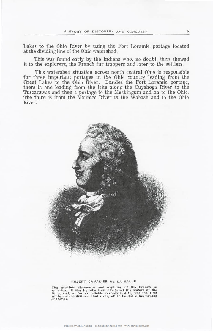
Robert Cavelier de la Salle
When de la Salle left Montreal in 1669 on a voyage of discovery it is generally believed that he chose the St. Marys or the Wabash River portage to reach the Ohio River. At that time the Miami Indians were in control of the western part of Ohio and because of de la Salle’s friendship for members of that tribe, it is thought that he may have used the Fort Loramie portage. This is borne out by the historical record that in 1680 at Fort St. Louis de la Salle granted parcels of land to his friends and followers, among them the Miamis and the Shawnees of the Ohio Country. The Miami Indians of the Ohio area were known as “Twightwees” translated into the “cry of the crane.”
De la Salle reported in his records that the French found the Miamis polite in manner and disposition and their “respect for and perfect obedience to their chiefs who had greater authority than those of other Algonquin tribes.” This polite disposition was probably one of the reasons why de la Salle chose to travel through the Miami country rather than through areas where the Indians were more inclined to fight the white man.
So the Fort Loramie area can boast of being one of the few sections of mid-America that was trod by white men as early as the 17th Century.
Ohio as French Territory
During this period Ohio was French territory. The French traders dealt with the Indians with whom they made a treaty in Montreal in 1701 and peace was declared between the various hostile tribes.
This gave the fur traders safe transport through the forests of Ohio to a permanent French mission set up at Detroit in 1728. There had been a French trading post at the mouth of the Maumee River as early as 1680. Both these facts would indicate that they were active through the Fort Loramie area during that time.
About this time in Ohio history there was great rivalry between the French and British for trade with the Indians and other development of the Ohio country. Some of the tribes favored the French from Detroit and other Canadian points while other tribes favored the British. Strange as it may seem, the preference appeared to be in the matter of “fire water” with the price of peltry almost taking second place. The French laced the Indians with a type of brandy while the English gave them rum. It seems the Indians found the quick effect of the rum more to their liking than the slow-acting, mild French brandy.
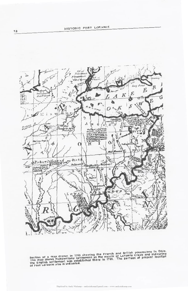
In the 1740’s and probably before that time there was established a large Indian settlement called Pickawillany at the mouth of Loramie Creek where it enters the Big Miami River. This site is south of the present village and was an important trail center. This meeting of many trails made the Indian settlement a logical trading center. The Miami or Twightwee Indians at this point had decided to abandon the French and had sought out the English to establish a trading post. The Ohio Land Company had been organized in 1748. The initiators of the company were mainly English from Virginia and included two half-brothers of George Washington, Lawrence and Augustus Washington.
The request for an English trading post at Pickawillany was made when a treaty was signed at Lancaster, Pa., between the six Indian nations and the colonies of Pennsylvania and Virginia.
The Pickawillany trading post was first set up by the Ohio Land Company because of it being at the center of a network of trails. From Pickawillany trails led in all directions. It was the main artery of travel between Detroit over the Fort Loramie portage. A trail to the south, following the east bank of the Miami River led to the area of the site of the future Fort Hamilton (Cincinnati) and on to the Kentucky hunting grounds beyond the Falls of the Ohio River.
Another trail led to the southeast to the Scioto River at Circleville. There the trail branched to connect with one on the west side of the river leading north to Sandusky and south to Shawnee Town which today is Portsmouth.
In 1752 the Pickawillany trading post and the Indian settlement were destroyed in a raid by the French aided by Indians of the Ottawa and Chippewa tribes. The French, having heard of the success of the English trading post designated the “English Trading House of the Miamis,” decided it must be captured and destroyed. The French demanded the surrender of the blockhouse. The English refused the demand and the attack followed.
The trading post was captured in the ensuing battle. Eight white traders were in the settlement at the time of the attack. Two of the traders escaped. One was stabbed to death and the others were taken prisoner. The village was destroyed along with all the houses and the trading post. The captives were marched to Detroit and then into Canada.
This battle and destruction of the English trading post is referred to by some historians as the first battle of the French and Indian Wars which ended finally with the French losing control of Ohio. The Pickawillany engagement spelled the end to the settlement and trading post which was never reestablished.
The location of the post at the mouth of Loramie Creek is marked today for those interested in seeing the site of the earliest white settlement in the Ohio country that figured so large in the destinies of the Indians and two great European nations.
Peter Loramie’s Trading Post
In 1769 the Fort Loramie area came into its own in history when Peter Loramie established a trading post at the portage. Choosing this point for his store was important because he was on the main thoroughfare between the Great Lakes and the Ohio River.
Peter Loramie was a great friend of the Indians. He was reported to have been a bitter enemy of the English and the American pioneers. Some historians have said that he was a Jesuit priest who was not permitted to function as a priest after 1773 because Pope Clement XIV suppressed the order in that year. From that time on, it is said, Loramie devoted his activities to operating his trading post for the benefit of the Indians.
Peter Loramie was reputed to have been instrumental in the many attacks by the Indians on settlers across the Ohio River in Kentucky. His dislike for the pioneers was shared by most French traders who wanted the Ohio country for Indian trading rather than for settlement.
The Kentuckians made many attacks across the Ohio River against the Indians but this warfare was mainly against Indian settlements around Old Chillicothe, near Xenia in Greene County, and at the Indian village of Piqua near the present city of Springfield in what is now George Rogers Clark national park.
It was not until 1782 that a concerted drive was made against the Indians in Ohio, first at Old Chillicothe, then at the Indian village of Piqua and finally at Peter Loramie’s trading post at the present Fort Loramie. In this campaign of Gen. George Rogers Clark the Indians were finally beaten.
In the attack on the Loramie trading post Gen. Clark designated Col. Benjamin Logan to carry out the attack. The raid came as a surprise. The store was plundered and burned. Peter Loramie and many of his Indian friends escaped during the battle and took refuge in the Indian town at Wapakoneta with other Shawnees.
“The trading post at the head of the Miami and carrying place (portage) to the waters of the lakes shared the same fate by a party of 150 horses commanded by Col. Logan.
“The property to a great amount was destroyed; the quantity of provisions burned far surpassed any idea we had of their stores.”
According to Col. John Johnson, Indian commissioner who made the official report, the store contained many goods and many peltry which afterwards were sold at auction by Gen. Clark’s orders.
The record gave an interesting sidelight in the story of an Irishman named Burke, one of Gen. Clark’s men. The soldier, Burke, while searching the post, came upon a rag wrapped around 25 “half joes” worth $200. While no one was looking, Burke secreted the money in a hole cut in an old saddle. During the auction that followed, the saddle was put up for bids. Burke, who was not considered too bright, was the only one to bid on the saddle. It went to him for a small sum of money. The story goes that Burke was joshed over his poor purchase until he reached into the hole in the saddle and pulled out the rag with the treasure.
The Loramie trading post was burned to the ground. Records show that Loramie left Wapakoneta with his Shawnee friends and emigrated to the Spanish territory west of the Mississippi and settled in a spot assigned to them at the junction of Kansas and Missouri.
While the trading post at the famed portage was not rebuilt by any other settler, the area continued to be of great importance since it was still on the important north-south waterway and trail. The Pickawillany creek, named for the earlier trading post at the mouth, now became known as the Loramie Creek and carries that name to this day.
Fort Loramie Is Built
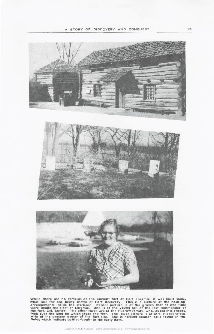
After the signing of the Treaty of Greenville in 1795 between Gen. Mad Anthony Wayne and the Indians it was decided that more protection should be afforded the settlers in the western areas of Ohio. As a result, Gen. Wayne ordered a fort built at the site of the Peter Loramie store.
The fort’s main objective was to protect such settlers who came to the area as well as to protect the portage. While there are no authentic records of battles fought at Fort Loramie, it is believed that there must have been some engagements because of the number of arrowheads and cannonballs found in the vicinity of the stockade.
The fort was occupied as a military establishment until 1812 when it was abandoned as a garrison.
The last commander of the fort was a Col. Butler who was the nephew of an earlier Col. Richard Butler who fell at St. Clair’s defeat in the Indian battle at the site of Fort Recovery.
It is recorded that Gen. St. Clair and the earlier Col. Richard Butler were caught in a surprise attack by Indians after a long, weary march. In the heat of battle Col. Butler was wounded seriously and thrown from his horse. Simon Girty, who was reported to have been leading the Indians in the attack on St. Clair’s troopers, passed the wounded colonel who pleaded with Girty to finish him off. Girty is said to have ignored the plea and walked away but one of his Indian warriors stepped up and killed Col. Butler with a tomahawk blow to the head.
The other Col. Butler who was the last commander at Fort Loramie was accompanied by his wife and 8-year-old son when he took over command of the fort. During this time the small son became desperately ill and died. The saddened parents buried the boy in the fort and during the years the fort was maintained the grave was decorated by the family. After the fort was abandoned and the property reverted to other use the grave became lost for a time. It was later discovered by the James Furrow family, reputed to have been the area’s earliest settlers, and was restored to its original condition.
With the removal of the fort a store was built on its site by the Furrows and was operated as a trading post and postoffice. After Furrow’s death, the store was moved into town which was then called Berlin. Furrow, his wife and son were buried on the grounds of the old fort site next to the grave of the small son of the last fort commander.
Because Fort Loramie lies in part north of the line dividing Indian territory from that of the settlers, the Treaty of Greenville stated:
“The Indian tribes agree to cede to the United States one piece of land six miles square at or near Loramie’s Store. The Indians also will allow free passage to the people of the United States from the commencement of the portage at Loramie’s store thence along the said portage to St. Marys.”
This, again shows Fort Loramie being on a line of national importance in those early days of American history. The town site, thus, was a special boundary of national lands included in the young republic.
The Community Is Settled
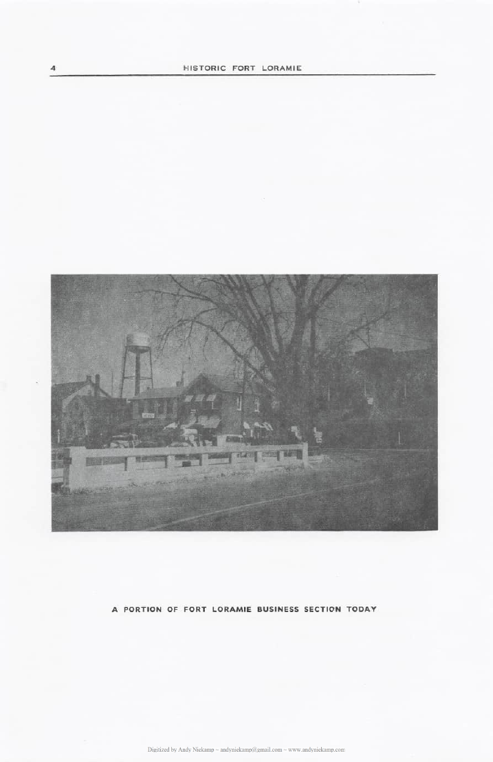
After the War of 1812 settlement began in earnest in the Fort Loramie area. Joseph Christian, Nathan Mendenhall, William Prillman and Jonathan Schell were among the first to take up land. James Pilliod took up land west of Fort Loramie. Isaac Edwards came in 1833. Edwards was the first school teacher in what is now McLean Township.
The original proprietor of Fort Loramie was William Prillman. The town was laid out west of the canal and was part of the Prillman farm. His brother, Christian Prillman, owned the land on the east side of the canal. The town was laid out and surveyed by Jonathan Counts. The canal line was staked out when the town was laid out but no work was done on the canal at that time.
The first general store in the community was operated by J. M. Pilliod. Lots in the town were sold at auction. The largest purchaser and landholder was J. M. Pilliod. The first physician was Dr. Clark Ayres. The first building in town was erected by Ishmael Lattimore. The first store was erected by Bernard Meyer. The first German settler was named Henry Weisbrod. He settled near where the reservoir bulkhead is now located. He was called the Dutchman by his community neighbors. The name of Berlin was given the town by both J. M. Pilliod and Charles Schultz who had come to the community from New Berlin in Stark County.
When work started on the Miami-Erie Canal in 1836 German immigration began in earnest. These people came mainly as laborers on the canal and soon took up land and became permanent settlers. The canal was opened in 1841.
Prior to the opening of the canal all supplies for the village and other communities were brought over poor roads in wagons on regular trips between Cincinnati and Dayton or Fort Wayne and Toledo. These wagons would be on the road for days and when night came the teamsters would stop at the farm home of some settler or would camp out.
Almost every resident along the road was known as a tavern-keeper because of caring for the road traveler. The wagon master would carry finished goods, groceries, clothing and machinery to the settler and on the return trip would be loaded with furs from the Indians, as well as wood products and farm produce from the settlers. Grain, pork and other items from the farm were the main commodities taken back to the cities.
With the opening of the canal much of this highway hauling ceased for the cheaper, faster waterway traffic and the numerous taverns returned to being farm homes again.
Hardly had the township been settled in 1849 when it was hit by an epidemic of cholera. Forty persons died in the Fort Loramie area and McLean Township. Minster, the town to the north, lost 300 to the disease. A deep trench was dug for the burial place of many of the Minster victims. A monument now marks the site of the mass grave in St. Augustine Cemetery.
Among Fort Loramie’s victims were Mary Furrow, widow of the community’s earliest pioneer and her son, James, Jr. Impure drinking water was believed to have been the cause of the epidemic. When residents took to boiling the water, the disease quickly subsided.
The first flour mill was built in 1858 by Bernard Meyer and the Reddy Brothers. It is still in operation as the Fort Loramie Milling Co.
John H. Willman came to Fort Loramie in 1854 from Cincinnati and established a general store the same year. At his death the business was taken over by his sons, Frank and Joseph who continue to operate it as Willman’s Department Store.
William Quinlan opened the town’s pharmacy and until his death was considered the oldest active pharmacist in the state. Two of the oldest, continuously operated taverns in the community are Brucken’s, started by Matt Brucken, and Ben Voglesang’s Cafe. Both have operated through the town’s colorful life during the canal period and afterwards.
The first grade school was built in “the forties” along the canal north of the village. The grade school was established in 1874 just east of St. Michael’s Church. The present high school was built in 1935.
Trails, Highways and Canals
Even in the days, long before the first white man visited western Ohio, there was traffic over the hills and valleys as the Indian tribes moved from place to place. The Miami Valley was considered a lush hunting ground and tribes migrated to the area for periods. This meant that trails converged from all directions. It is recognized that Pickawillany, south of Fort Loramie at the mouth of Loramie Creek as it empties into the Miami River, was an important trail junction. Trails led from the Ohio River to the Great Lakes. These followed the river to the Loramie portage and on along the St. Marys River to the Maumee and on to the lake. The river and creek route was probably for hauling while the trail served when the waterways were frozen over during the winter months.
With the coming of the white pioneer these waterways and trails were still used and in later years roads were made by widening the trails. Some of these early roads served western Ohio until recent years when faster motor traffic necessitated straightening and otherwise improving the thoroughfares. But in many places the early trails and traces are still marked as secondary roads leading to farm communities.
In the early days of Ohio the great lack was for roads leading from lush farms to the markets of Cincinnati and Toledo as well as points in between.
In 1822 these back country areas got little for their commodities. Records show that wheat sold for 25 cents a bushel, corn 12½ cents, oats 14 cents, potatoes 18¾ cents, pork 2 cents a pound, beef 3 cents, butter 6 cents, eggs 6 cents a dozen and chickens 5 cents each.
Had there been roads of any consequence between these areas and the markets in Cincinnati flour would bring $3.50 a barrel. In New York the same flour brought $8. Transporting such commodities by road ran to a cost of $25 a ton. It was argued that if a cheaper way could be found to move this flour to other centers a handsome profit could be realized for the Miami country farmer.
In 1825 there was agitation for a series of canals in the state. It was figured, and rightly, that canal hauling charge would be at $3 a ton against $25 by roadway.
But for that year the total state revenue from all areas was $131,753.48. With this small income it was not considered possible to talk of canal construction. A survey made in 1825 showed that a canal running from the lake, through Columbus and on to Portsmouth, and one running from Toledo to Cincinnati, through Fort Loramie, Piqua and Dayton would cost an estimated $5,715,203.
Despite the financial situation in the state and this unheard of cost, the canals were authorized and work was started on the Miami-Erie Canal July 21, 1825. It was completed in 1845 and opened for business. The two canal systems finally cost $15,967,652.69.
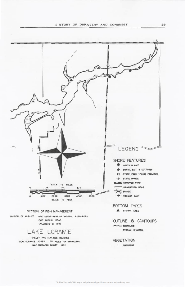
This was three times the original estimate but the higher cost was partly explained through additional feeder lines to other towns which had not been considered on the first estimate. The cost of the Miami-Erie Canal was $8,062,680.80. This included the cost of three reservoirs. St. Marys Lake cost $582,222.07. Indian Lake reservoir cost $600,000. The reservoir which is now Lake Loramie cost only $22,000. The reason for the small cost of the Loramie reservoir is not explained in the records. The Miami-Erie Canal, when in use, was 301 miles long.
The canal brought many people to western Ohio and with the influx came new towns and industries because, during the first 35 years of the canal operation, it was considered the finest, and cheapest mode of transportation. Canal boats carried quantities of produce and other types of freight and passenger traffic between Cincinnati and points north and on to Lake Erie.
The canal passed through the center of Fort Loramie and because of it the town grew in importance and in wealth. The canal, in many ways, made Fort Loramie because most of its citizens came to the area to work either on the canal itself or on the reservoir adjacent to the town. Most of those who arrived were Germans. They came up from Cincinnati and in many cases were direct from Germany. They brought with them their customs and their church. The two go hand in hand yet today.
Cincinnati was a clearing house for canal workers. If they were Germans, the workers were told of the German communities at Berlin (Fort Loramie) and Minster to the north. If the worker was French, he was directed to the French communities of Versailles, French Town and Russia not far distant to the west. If the worker was Irish, he settled at St. Patrick which is just east of Fort Loramie. In all cases, the workers usually were Catholic and these various communities grew up to be almost solidly Catholic.
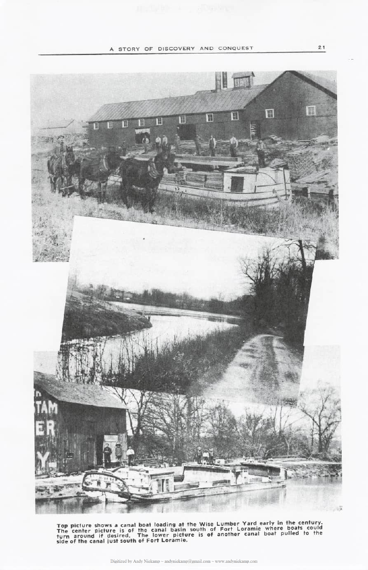
By 1909 the canal was almost a thing of the past as a first class transportation system. This came about by the network of railroads that were expanding in all directions. The railroads were faster and, in turn, cheaper than the canals. An accounting of the canal system made in that year showed that the waterways had been losing money for some time. In the first 35 years of operation the canals showed a profit of $7,074,111. But this evaporated in later years until, in 1909 the system showed the following records: Cost of construction, $15,867,652.69. Maintenance from opening of waterways $13,065,011.13. Total cost of canal system $29,023,633.82. Gross receipts $17,225,337.05. Deficit $11,798,326.77.
What the state lost in revenue, it gained in towns, population and industrial development. In comparison with today’s high cost of highway construction which averages about $1,000,000 a mile, this cost was small and the results great.
There were many types of canal boats. There were freighters, workboats, passenger packets and some private pleasure boats. They all ran in size from 60 to 72 feet in length and a standard width in order to pass through the waterway and locks. The freighters were sturdy affairs with cargo stored in the hold, and on the top deck as well. Huge doors permitted trucking freight on and off the boats. There was a captain’s cabin which had glass windows with curtains.
Passenger packets carried up to 50 persons. They were usually express packets which made the 300 mile run from Toledo to Cincinnati in four days and five nights. These speedy (for that day) boats made between six and eight miles per hour and were pulled by from two to six horses. A change of horses was usually carried on the packet itself. Because of its express designation it usually demanded the right of way. Many times a freight boat captain would argue this point and the argument ended in fisticuffs. Usually the dispute would take place at the locks and the lock tender would be called upon to referee the matter.
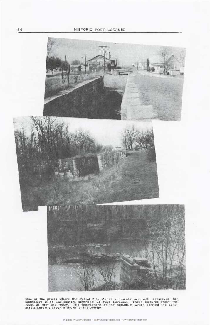
One of the busiest areas on the canal was just south of Fort Loramie at the village of Lockington. At this point was built an engineering feat for bringing the boats from a lower level up a hill to the upper level, a height of 67 feet in one half mile. This made Lockington a thriving canal town because there would be a long line of boats waiting to traverse the six locks in tiers going in both directions. Old timers recall the tooting of the horns on the boats trying to hurry the passage. As many as 400 boats a day would pass this point.
After the abandonment of the canal there was no longer any maintenance along its length. Areas grew up in weeds and became unsightly. This situation developed along the stretch of the “ditch” within the town and became an eyesore in the business section of Fort Loramie.
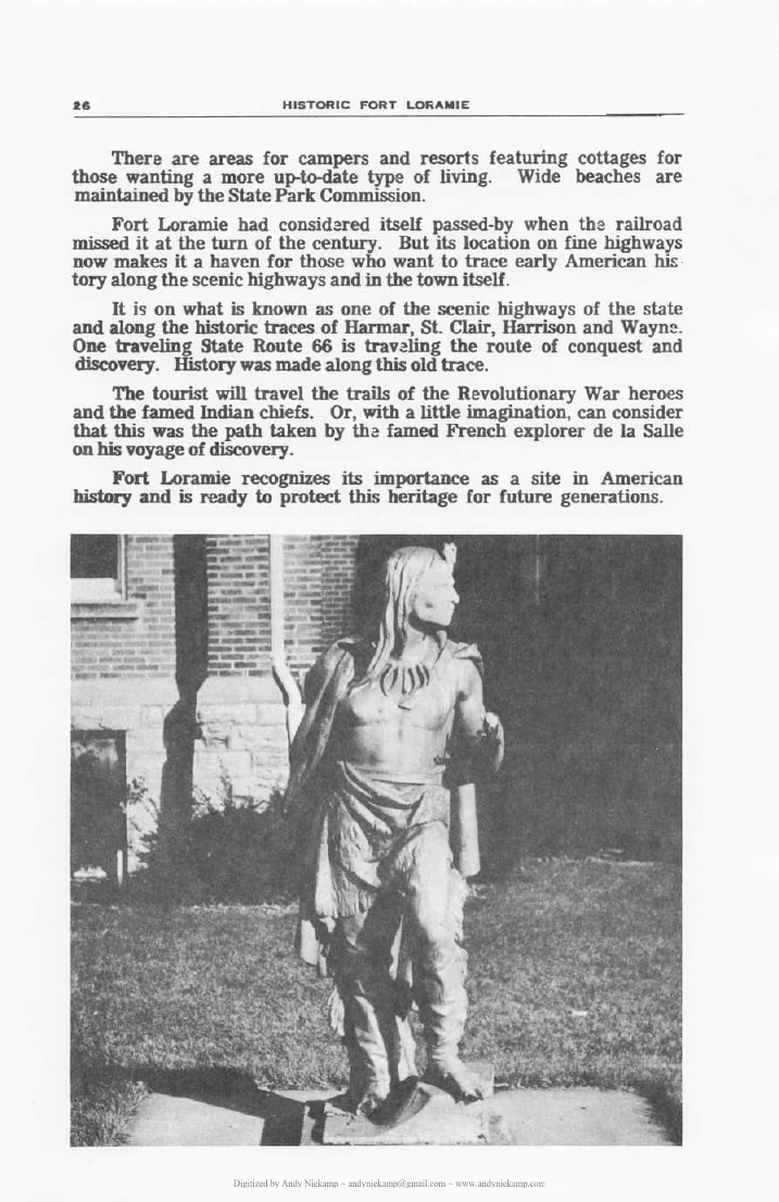
A group of young women decided to do something about the situation. They organized “The Village Beautiful Club” in 1914. The canal banks were cleaned up and all weeds were removed. Sod was laid and the sloping banks were further landscaped. In the center of the project an area was fixed up for a monument. Here the women of the organization placed the statue of an Indian overlooking the business houses on the east bank. The club had purchased the Indian statue from the estate of Julius Boesel in New Bremen. The statue, which has become a real part of the tradition of Fort Loramie stood on that site for many years until the town decided the condition of the water in the canal necessitated filling it in through the business section. The canal area then was made into a public park. There was no place to put the Indian statue and it was removed to its present site in front of the Fort Loramie School.
The most important remaining feature of the early canal days is beautiful Lake Loramie, located a short distance from the town. This reservoir, which kept the canal filled with water, is now a haven for the fisherman, the boatman and the vacation-bound Ohioan. There are areas for campers and resorts featuring cottages for those wanting a more up-to-date type of living. Wide beaches are maintained by the State Park Commission.
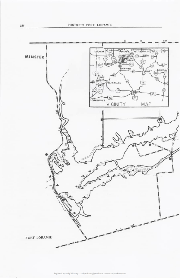
Fort Loramie had considered itself passed-by when the railroad missed it at the turn of the century. But its location on fine highways now makes it a haven for those who want to trace early American history along the scenic highways and in the town itself. It is on what is known as one of the scenic highways of the state and along the historic traces of Harmar, St. Clair, Harrison and Wayne. One traveling State Route 66 is traveling the route of conquest and discovery. History was made along this old trace.
Fort Loramie and the Revolution
Some present-day historians in retrospect have come to judge the 1780-82 campaign of Gen. George Rogers Clark in the Miami Valley one of the most important of the Revolutionary War. These engagements saw the complete destruction of the Indian settlements at Old Chillicothe, Piqua, near Springfield, and Peter Loramie’s trading post at Fort Loramie. They were vital factors in the opening of western Ohio, protecting Kentucky, an El Dorado for pioneers; and dissolving the coalition of the British and Indians. Thus, the rearguard of the American colonies in the east was maintained during the darkest hours of the Revolution, the time of the treason of Benedict Arnold.
These victories for Gen. Clark made it impossible for the British ever again to raise the tribes for concerted aggressive action against Kentucky. Clark thus saved Kentucky and Kentucky saved the west.
The portage at Fort Loramie figured big in these battles which were the last blows of the Revolution in the western settlements.
In the spring of 1780 British Col. Henry Bird, with 600 Indians, British and Canadian soldiers floated cannon and other equipment down the waterways from Detroit to where Cincinnati is now located. He then crossed the Ohio River and moved against two important Kentucky settlements, Martin’s and Ruddell’s Stations. The British force breached the stockades and took 300 to 400 captives. This was the greatest number of settlers ever captured in an Indian battle.
Along with Col. Bird were the notorious Girty brothers, Simon and George who usually made their headquarters around what is now St. Marys with their Indian friends. Few of the unfortunate captives were ever recovered.
After these two disasters, Gen. Clark raised an army of 1,000 Kentuckians with two cannon and marched in pursuit. Some of the Kentucky captives were found to have been tomahawked along the route to Detroit and it is believed that the survivors ended up in that northern British bastion.
The object of Gen. Clark’s campaign was the British-built fort at Piqua, near Springfield, which actually was a powerful Shawnee base. The desperate battle there ended in the complete destruction of the fort and the Indian settlement along with all crops and equipment. During the battle a cousin of Gen. Clark, Joseph Rogers, who had been a captive for four years, was found to have been fighting on the side of the Indians. Dressed as an Indian, it is reported that he attempted to make an escape to the side of the Americans as the Shawnees were being routed. He is said to have called to the settlers that he was white and was trying to escape from his captors. As he rushed toward the American lines he was shot down. It was not sure whether he was shot down mistakenly by one of the pioneers or by an Indian who saw him deserting. At any rate, the story is told that young Rogers died in the arms of his uncle, Gen. Clark.
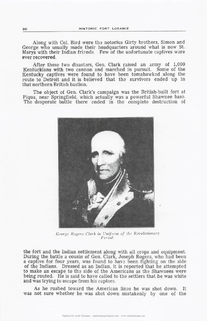
Gen. Clark designated Col. Benjamin Logan to continue the campaign against the Indians and sent him with 150 Kentuckians on horseback to clean out the Indian settlement around the trading post of Peter Loramie. This victory in 1782 made safe the waterway and north-south trails for peaceful use.
While there were battles between the Indians and pioneers after that time, there was no further effort by the British to bring concerted action against the western pioneers.
The portage at Fort Loramie figured, however, in almost every campaign or historic record of the area for further years. Gen. Joshua Harmar used this portage in 1790 after his defeat at Fort Wayne. Gen. Mad Anthony Wayne used the same trail from Greenville where he had set up winter quarters in 1794 before concluding the peace treaty with the Indians in 1795.
In 1812 Gen. William Henry Harrison, with a small band of troops, marched from Fort Washington (Cincinnati) to Fort Wayne passing over the same trail. The central division of Harrison’s army used this same trace again in 1812 and 1813 to Fort Meigs.
Thus this historic trail and portage at Fort Loramie figured big in winning of the west.
The impact of Gen. Clark, his officers and men was great on the outcome of the Revolution. It is said that it is conceivable that had there been no Gen. Clark, there might not have been a United States of America. For had the campaign against the British in 1780-82 failed, a hoard of savages and British larger than the army which Cornwallis surrendered at Yorktown would have been turned loose from the west on the American colonists in the east.
And supplies from pioneers beyond the Alleghanies, which played a more important part in the final victory than is generally known, would have been cut off from the American colonists.
General Clark broke the power of the British and the Indians in the territory northwest of the Ohio River. Upon the basis of his victories over the common foe, Benjamin Franklin succeeded in the treaty of Paris in maintaining the claim to the Northwest Territory as an integral part of the new nation and established the Mississippi and Canadian boundary lines as the western and northern limits of the new land of freedom.
St. Michael’s Roman Catholic Church
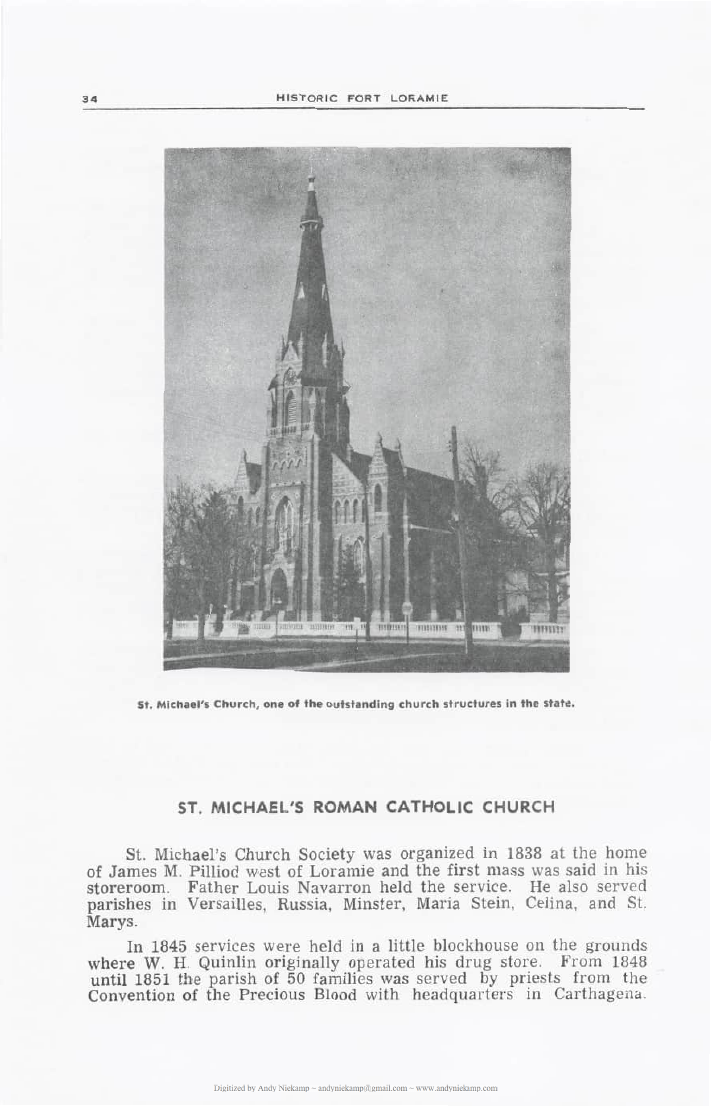
St. Michael’s Church Society was organized in 1838 at the home of James M. Pilliod west of Loramie and the first mass was said in his storeroom. Father Louis Navarron held the service. He also served parishes in Versailles, Russia, Minster, Maria Stein, Celina, and St. Marys.
In 1845 services were held in a little blockhouse on the grounds where W. H. Quinlin originally operated his drug store. From 1848 until 1851 the parish of 50 families was served by priests from the Convention of the Precious Blood with headquarters in Cartagena.
In 1851 Fort Loramie received its first permanent pastor, Rev. Augustin Berger. It was during the pastorhood of Father Berger that the first brick church was opened. Although started in 1849, work was delayed because of the cholera epidemic. It was finally completed in 1851 and was a plain structure with a tower and belfry containing two bells. An addition built several years later gave the church an overall measurement of 40 by 80 feet. The old church was incorporated into the present church in 1879 and is now used as a chapel.
Father Berger was succeeded in 1858 by Rev. Harry Muckerheide, a native of Oldenberg, Germany, who served the parish until 1864. He was succeeded by Rev. Anton M. Meyer of Aesch, Switzerland. Father Meyer served the parish 10 years during which time he enlarged the church and built the brick school house near the church.
He was succeeded in 1874 by Rev. William V. Bigot during whose period in Fort Loramie a historical piece was written about the church and the times of the area.
Father Bigot was born in Alsace in 1838 and was educated in France and Switzerland. He was well advanced in the classics and leading modern languages as well as having a thorough scholarship in philosophy, theology, history and liturgy of the church. In the Franco-Prussian War he had at one time been appointed military clergyman over 15,000 French captives. After the war he was chosen chief commissioner of a bureau for collecting and tabulating death records of French soldiers who died as prisoners of war in Germany. More than 18,000 of these mortuary records were secured. He had monuments placed over the graves of the fallen French soldiers. For this he was given the Cross of Chivalry by the French government. He was assigned to the Fort Loramie Parish, St. Michaels, in 1874 and remained as parish priest for 30 years.
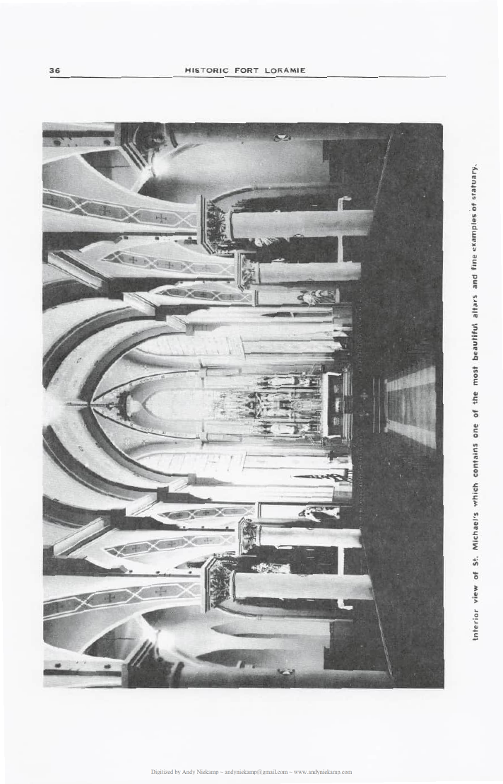
Through his efforts St. Michael’s present church was built. It is considered one of the most beautiful churches in the state.
Father Bigot was told by Archbishop Purcell of Cincinnati that in addition to his regular duties as pastor there was need for a new church. In 1878 preparations were made for the building. Subscriptions were taken in 1879 and during the same year work was started on the excavation. In October, 1879 the cornerstone was laid which was witnessed by 2,000 parishioners and their friends.
The new church was consecrated in 1881. It was then, and still is, considered one of the most outstanding church structures in the Cincinnati Archdiocese. Cost of the building was placed at $60,000 and for the parsonage $10,000. A similar structure built today would cost more than ten times that amount.
Father Bigot stayed in the parish until 1903 when he was succeeded by the Rev. August Adelmann. In 1910 Father Anthony Moeller took over the parish. He held the post until 1952 when he was succeeded by Father Clarence Leibold who is still in charge of the parish.
Later Community History
The later chapters of Herbert K. Skinner’s work document the continued growth of Fort Loramie through the mid-20th century. Topics covered include the Peter Loramie name controversy, the Fort Loramie Development Corporation, local youth organizations, the American Legion post, the Loramie Banking Company (chartered 1915), village government under Mayor Urban E. Ratermann (who became mayor at age 26 in 1952), County Commissioner Francis DeLoy, and the Fort Loramie Community Fire Company (organized 1883 under the leadership of Rev. William Bigot after the Rattermann Mill fire).
By the early 1960s the village population had grown from 506 in 1940 to approximately 750. The banking house reported assets exceeding $4 million. The volunteer fire company continued to serve McLean, Cynthiana, and Turtle Creek townships with modern equipment.
Throughout these later pages the author emphasizes the enduring German Catholic character of the community, the lasting imprint of the Miami-Erie Canal era, and the pride residents take in preserving the memory of the portage, the fort, and the explorers and settlers who passed through this strategic watershed.
Fort Loramie recognizes its importance as a site in American history
and is ready to protect this heritage for future generations.